The web site, Caledonia Hilltreks details my ascents of the Munros, Corbetts, Grahams and New Donalds all of which are above 2000 feet. This blog will contain an account of my ascents of the hills below this height as and when they are climbed.

Wednesday 29 December 2010

Beinn an t-Sidhein, Trossachs

Beinn an t-Sidhein

Beinn an t-Sidhein, Trossachs. – Section 1C.
Height – 572 meters. Map – OS Landranger 57.
Climbed – 26 December 2010. Time taken – 3 hours.
Distance – 6 kilometers. Ascent – 525 meters.
Trip Report Details:

The forecast was for windy and deteriorating weather conditions later in the day so I settled for a morning ascent of the Sub 2000 Scottish Marilyn, Beinn an t-Sidhein.

I parked in the Forestry Commission car park just off the main street (A84) in the village of Strathyre. The surface was covered in hard packed snow so before leaving I fitted my microspikes. It was a short walk to the partially frozen River Balvag, which I crossed via a footbridge, and onto the single track road on its west side.

This road was followed north to beyond the school where a blue and green marked trail led through the trees. The path was closed off for forestry operations but as it was a Sunday and Boxing Day I thought work would be suspended for the holiday.

The path climbed steeply through the trees to a vehicle track where a large forestry vehicle was parked. It was frozen over so I concluded that work was on hold and walked north along this track for a few metres to where cut timber was stored. Here I took a left onto another vehicle track where I located the blue/ green marked trail.

It was again a steady climb before I emerged onto a third vehicle track where the blue and green routes split. On checking out the blue route it appeared to enter an area of recently cut timber so I decided on the green route which headed north through mature trees.

I was aware that at some point I would have to leave the forest trails and make my own way uphill and onto the open hillside. At the end of the area of mature trees I came to a small stream with some recently planted trees beyond, and decided that this was the point to leave the track. The lying snow was fairly firm and concealed most of the bracken and other obstacles, otherwise underfoot conditions would have been considerably more awkward. There were some deer prints and I spotted a few deer higher up.

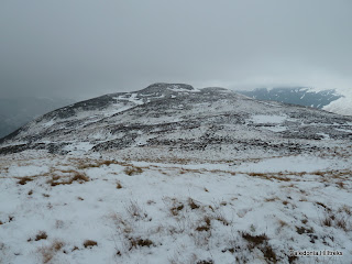
On reaching the top of the forest there were two fences to cross. The deer fence was all but collapsed so I stepped over it and the second lower fence was newer but easily crossed. This took me onto the open hillside and I walked across patches of snow and bare heather to climb to the summit of Beinn an t-Sidhein, marked by a few stones and a stick.

I continued out to Beinn Luidh where I had better views across Balquhidder to Kirkton Glen and beyond Strathyre to Loch Earn. The higher tops were covered in cloud and it was forming around frozen Loch Lubnaig. Despite snow flurries I had a quick coffee break before returning by the ascent route.

Photos taken on walk.
Monday 15 November 2010

Carn Fiaclach, Glen Affric.

Carn Fiaclach

Carn Fiaclach, Glen Affric. - Section 11B
Height – 457 metres. Map – OS Landranger 25.
Climbed - 29 October 2010. Time taken – 3.75 hours.
Distance – 5.5 kilometres. Ascent – 330 metres.
Trip Report Details:

We had been staying for a few days in Tomch and as my walking friends were returning home on what was a very windy morning I decided to climb this nearby Sub 2000 Marilyn. It was a short drive to the Dog Falls Car Park in Glen Affric, where there were plenty of parking spaces.

I walked across the bridge over the River Affric and followed the vehicle track that headed south-west through the forest gradually gaining some height. At a junction of tracks I took the right fork and continued in the same direction searching for a suitable point to scramble through the forest onto this hill. I never found one and when the track started to loose height I decided that I had little option but wade my way through the forest undergrowth if I was going to reach the summit of this ‘little hill’. The map hadn’t helped as Carn Fiaclach was shown as surrounded by forest.

Firstly there was an area of watery ground to traverse before commencing a fairly steep climb through the trees. Underfoot the long vegetation, heather, mosses and some fallen timber made progress slow and awkward but eventually I appeared on the west ridge of Carn Fiaclach. It was then a short walk to the summit where a metal pole marked the top. I found some shelter from the wind for a coffee with views of Loch Affric and the cloud covered Affric Munros.

Maybe it was a mistake taking a coffee break, as while seated at the summit I decided to return by descending the north-east ridge which was initially quite pleasant. However lower down the vegetation and some rocks made the descent pretty awful so I wouldn’t recommend this route. Low down on the ridge I came to the vehicle track which I followed in a south-westerly direction until it joined the track used earlier that day. It was then a short walk back to the car park.

On checking Google the metal pole on the summit may be a trig point for the hydro electric station.

Photos taken on walk.

Tuesday 9 November 2010

An Lean-Charn, Far North

An Lean-charn

An Lean-charn, Far North. – Section 16B
Height 521 metres. Map – OS Landranger 9.
Climbed – 25 October 2010. Time taken – 3.5 hours.
Distance – 8.5 kilometres. Ascent – 550 metres.
Trip Report Details:

I was heading south to Cannich later in the day so this Sub 2000 foot Marilyn appeared to meet my requirement for a morning walk.

I drove west along the single track A838 Tongue to Durness Road to the head of the sea loch, Loch Eriboll. Despite being in some wild country there were few parking spaces. Once I managed to get my car off the road I headed south along a vehicle track to a couple of gates which were in poor condition. Here there was a sign giving advice during the stalking seasons, but no indication if stalking was taking place that day. However there was a contact number but I doubt if my mobile would have worked in such a remote location.

The vehicle track headed round the west side of the craggy, Creag na Faoilinn and along Srath Beag. However once beyond the crags I left the track and climbed east over some wet and rough vegetation as I made my way towards my target hill, An Lean-charn. The plan was to use the three lochans to the south-east of Creag na Faoilinn as navigation aids but the weather was clear enough for me to make a direct ascent. The ground did steepen in places but there was no real problem. A small dip containing a lochan was crossed before the final climb to the summit cairn of An Lean-charn.

Here I had a coffee break with views of Ben Hope and Lochs Hope and Eriboll.

My return was by the ascent route with views of the Corbetts, Foinaven, Cranstackie and Beinn Spionnaidh as the cloud lifted clear of their tops.

Wildlife spotted on this walk included deer, grouse and a vole.

Photos taken on walk.

Monday 11 October 2010

Craig of Monievreckie, Trossachs.

Menteith Hills

Craig of Monievreckie, Trossachs. Section 1C.
Height – 400 meters. Map – OS Landranger 57.
Climbed - 20 September 2010. Time taken – 4 hours.
Distance – 12.5 kilometres. Ascent – 550 metres.
Trip Report Details:

I was staying in the Trossachs and on advising my host I was planning climbing Craig of Monievreckie she offered me a lift to the start if I would take her dog with me. Not a problem as this would allow me to make the ascent of this Sub 2000 Marilyn a linear walk.

I was dropped off at the Braeval Forest car park on the A81 Port of Menteith to Aberfoyle Road and followed the ‘red route’ through the forest as indicated on the web site ‘Scottish Hills’. High up in the forest an unmarked path led along the side of a stream to a new gate in the mesh type fencing and this gave me access to the open hillside.

A walker’s path meandered through the bracken and onto the south west ridge of Craig of Monievreackie. The path was followed over a few knolls to the summit trig point where I had a coffee break with views of the Lake of Menteith and Ben Venue.

Afterwards I continued along the ridge to the Bealach Conasgach where I took the wrong option. Instead of continuing along the ridge I descended to the Rob Roy Way. This route was pretty awful as it was through long bracken and trees. I don’t think the dog enjoyed the experience either.

Eventually I came to the Rob Roy Way and made good progress through the forest until I reached a gate giving access to an open field. The gate was tied with wire which was impossible to undo. Even a gap in the gate was tied with barbed wire. There was a stile over the adjoining dyke and wire fence but it wasn’t suitable for dogs. I tried to entice the dog over the wall and through the fence, which also had a barbed wire strand, but without success. In the end I had to remove part of the wall then lift and push the now agitated dog through the gap and over the fence.

I rebuilt the wall and walked across the field, containing a few sheep, to the other side. Again I was confronted by a gate which this time was padlocked. Stones appeared to have been removed from the dyke and replaced so I did likewise.

We then walked through the forest, passed Lochan Allt a’Chip Dhuibh, and onto a forest track. This track was followed east before I came across signs restricting access due to forest operations. There was no obvious alternative route so I continued along the track but fortunately no one was working although a large area of the trees had been harvested.

The track took me to the East Lodge at Invertrossachs before the dog entered Loch Venachar for a swim and wash. We then continued along the road until we were picked up east of the Gobhain Bridge.

Photos taken on walk.

Friday 8 October 2010

Benaquhallie, Aberdeenshire.

Benaquhallie

Benaquhallie, Aberdeenshire. Section 21B.
Height – 494 metres. Map – OS Landranger 37.
Climbed - 12 September 2010. Time taken – 0.75 hours.
Distance – 3 kilometres. Ascent – 195 metres.
Trip Report Details:

This was my third and final Sub 2000 Aberdeenshire Marilyn for the day. I was en-route home along the B9119 Tarland to Aberdeen Road and west of Tornaveen drove up the single track road that led to Upper Broomhill Farm. At the end of the tarred road I parked at the side of the access road leading to Upper Dagie, where it appeared renovations were in progress.

I walked the short distance to Upper Broomhill Farm then along the west side of the farm buildings which led to a gate in an electric fence. Once through the gate I crossed a field, initially following grassy vehicle tracks, to a wall and a few trees, which led to the top fence. Here I found all four strands of the fence were electrified. I didn’t notice until the descent that slightly to the west there was a short section with rubber tubing round the wires to facilitate a crossing. In the process of climbing the fence I did discover that it was in fact live.

Beyond the fence there was deep heather to contend with as I continued the ascent. I reached a large cairn and a short distance further north the summit trig point, where I had views of Craigievar Castle, the Howe of Alford and Aberdeen.

The return was by the ascent route crossing the fence where the rubber tubing protected me from another electric shock.

Photos taken on walk.

Coiliochbhar Hill, Aberdeenshire.

Coiliochbhar Hill

Coiliochbhar Hill, Aberdeenshire. Section 21B
Height – 533 metres. Map – OS Landranger 37.
Climbed - 12 September 2010. Time taken – 2 hours.
Distance – 6.5 kilometres. Ascent – 210 metres.
Trip Report Details:

The start of this walk was the unclassified Cushnie to Kildrummy Road, just west of Upper Minmore. I parked my car on the verge before passing through a gate and following a vehicle track along the edge of a field. This led to another gate which was tied at both ends. I climbed over this gate and continued along the track, across a field, to second tied down gate. The crossing of this gate was a bit awkward as it was in poor condition and the lower section was covered in wire netting.

Once over this third gate the track led through a forested area where new trees had been planted to replace those harvested. At the upper end of the forest there was no gate so I continued along the track, over heathery moorland, towards a cairn.

Beyond the cairn I came to another forested area and thought of walking round the edge but opted to follow a fence through the wood. The fence wasn’t easy to follow as there was quite a bit of fallen timber although in a strange way it was quite pleasant wandering through the old forest. Eventually I reached the northern edge of the wood and followed the fence to a cairn marking the summit of Coiliochbhar Hill.

It was quite breezy here so I returned to the edge of the forest where I had my lunch before returning by the ascent route.

Photos taken on walk.

Thursday 7 October 2010

Lord Arthur's Hill, Aberdeenshire

Lord Arthur's Hill
Lord Arthur’s Hill, Aberdeenshire. Section 21B.
Height – 518 metres. Map – OS Landranger 37.
Climbed - 12 September 2010. Time taken – 2.25 hours.
Distance – 8 kilometres. Ascent – 350 metres.
Trip Report Details:

I decided to climb this hill from the east as it made for a slightly longer and easier walk than the approach from the south. Dubston Farm was my starting point, reached from Tullyneesle on the single track road leading to Tullynessle Castle. Near the end of this tarred road there was a rough area of ground where I parked my car.

It was a bright and slightly breezy morning when I set off along the farm road leading to Dubston. I walked round the back of this farm onto a vehicle track which soon entered a fenced off area where new trees had been planted. A sign indicated that I was on the ‘Quarry Walk’ and that responsible walkers were welcome.

Beyond the fenced area the track followed the south side of the Esset Burn before it later split. The ‘Quarry Walk’ appeared to head north towards an old quarry and onto the Correen Hills while my route continued in a westerly direction following the track shown on the map as Fouchie Shank. Higher up the path passed through some larch and Caledonian Pine trees before crossing more heathery ground to reach Lord Arthur’s Cairn.

The summit trig point was slightly further to the north so I visited it where I had views of the Correen Hills and The Buck. I returned to the shelter of the cairn for a coffee break looking out over the Howe of Alford and to Coiliochbhar Hill.

The return was by the ascent route. Near Dubston Farm I met a group, who with the availability of two cars, were walking to Mossat.

Photos taken on walk.

Thursday 26 August 2010

Allermuir Hill, Midlothian.

Allermuir Hill

Allermuir Hill, Midlothian. Section 28A
Height – 493 metres. Map - OS Landranger 66.
Climbed - 20 August 2010. Time taken – 1.5 hours.
Distance – 5 kilometres. Ascent – 365 metres.
Trip Report Details:

The weather forecast wasn’t very good so I was planning on leaving Edinburgh and returning home. However some early morning blue sky convinced me to firstly take in this Sub 2000 Hill.

I drove the short distance to the Hillend Ski Centre, on the outskirts of Edinburgh, and parked in the upper car park. By this time there was some light rain falling so it was on with the waterproofs before setting off up the side of the dry ski slope. Unfortunately cloud was floating around the hill tops, although the rain had eased.

There were various paths and I followed one that led onto the east ridge of Caerketton Hill where there was a directional sign. A couple of dog walkers were about as was a runner heading up the hill. I followed the fence line and path to the east top of Caerketton Hill which was in the cloud. A short descent and another climb took me to the summit of Caerketton Hill but the views weren’t great due to the cloud.

A steeper descent and re-ascent took me to the viewfinder and trig point on the summit of Allermuir Hill. It was rather windy here but at least I had some views of Arthur’s Seat, The Castle, and across the City of Edinburgh to the Firth of Forth and Fife beyond.

It was a bit too windy to linger at the summit so I returned down Allermuir Hill’s East Ridge and followed the path below Caerketton Crags towards Swanston Golf Course. A marked trail followed a path above the golf course back to the ski centre and the end of short but enjoyable hill day, despite the weather.

Photos taken on walk.

Saturday 21 August 2010

Hill of Fare, Aberdeenshire.

Hill of Fare

Hill of Fare, Aberdeenshire. Section 21B.
Height – 471 metres. Map – OS Landranger 38.

Climbed – 15 August 2010. Time taken – 3.5 hours.
Distance – 12.5 kilometres. Ascent – 400 metres.
Trip Report Details:

It was a sunny morning when I set off, from my home in Aberdeen, for the short journey to the start of this walk at Raemoir, near Banchory. I drove west along the B9125 and at its junction with the A980 turned right to the Raemoir House Hotel. Here I enquired about parking and was directed to a triangular area of grass at the rear of the Hotel.

Once geared up I walked along the vehicle track, through Spy Brae Wood, and on towards the vacant buildings at Burnhead, passing through a gate with a warning sign regarding wildlife management and firearms in use. From Burnhead the gradient increased as I climbed through Craigbeg Wood before emerging from the forest below The Skairs. It was cloudier now but with very little wind the flies were a real nuisance.

The track continued below the south side of Craigarth before heading almost to its summit. This was followed by a gradual descent to a swath of ground where electric cables had been buried. Hopefully in a few years it won’t be so noticeable. A lockfast wooden hut was passed as height was regained and a roe deer stood and watched me then ran off.

Hill of Fare consists of a number of tops but the highest point was at 471 metres, just off a bend in the track. To reach this point, which was marked by a boulder and a couple of stones, involved wading through some long heather. I did make a search of the area before I was satisfied that I had reached the highest point. The flies were still a nuisance and I returned by the ascent route.

Photos taken on walk.

Thursday 22 July 2010

Beinn Mhialairigh, Loch Hourn.

Beinn Mhialairigh

Beinn Mhialairigh, Loch Hourn. Section 10A.
Height – 548 metres. Map – OS Landranger 33.
Climbed - 18 July 2010. Time taken – 5.25 hours.
Distance – 12 kilometres. Ascent – 1325 metres.
Trip Report Details:

My plan was to climb the Munro, Beinn Sgritheall from the west through Collie Mhialairigh. On studying the map, and my copy of ‘The Relative Hills of Britain’, I discovered there was a Sub 2000 Marilyn, Beinn Mhialairigh to the west of Beinn Sgritheall.

I drove from Glenelg towards Arnisdale on the single track road along the north shore of Loch Hourn. Opposite Eilean a’Chuilinn I located the cairn marking the start of the path to Bealach Rarsaidh. (NG818119) Just to the west of this cairn there was a passing place where a single vehicle can be parked off road.

Waterproofs were donned before I set off up the path which was initially like a wee stream as water was running down it. The path was quite eroded, muddy in places, steep in sections and at times difficult to follow as it wound its way through bracken and silver birch trees which were growing close together. I was glad of the waterproofs as I pushed my way through this wet vegetation.

It was hard work but on looking back I had views up Loch Hourn to Barrisdale Bay. Eventually I came to a deer fence where there was a stile (NG817124) and after a bit more climbing reached Bealach Rarsaidh and its lochan of the same name. Low cloud was floating around and it was a bit windy, however I found some shelter for a coffee break.

A small cairn marked the start of the path up the west ridge of Beinn Sgritheall. The walking was relatively easy, although I was being buffeted by the wind, and there were no views due to low cloud. Higher up the path was steeper and stonier and I was a bit more exposed to the wind. There were also a couple of easy rock steps to scramble over before I reached piles of stones and a broken trig point. Due to the weather there was no point in remaining at the summit so I returned to the Bealach Rarsaidh. As I descended the cloud base rose and I had some views.

On the west side of Lochan Bealach Rarsaidh I crossed the deer fence by another stile and commenced the ascent of the west ridge of Beinn Mhialairigh, firstly climbing over Creag an Taghain where a couple of grouse took off. Beyond this small rise it was a relatively easy walk, although the deer fence had to be re-crossed on this occasion without the assistance of a stile. As I approached the summit of Beinn Mhialairigh the cloud unfortunately lowered again and the summit was engulfed.

At the summit cairn I had lunch hoping that the cloud would lift again. There were a few breaks but not for very long. This hill would be a great vantage point on a fine day especially for the views down the Sound of Sleet and across to the Isle of Skye.

I eventually gave up and returned down the west ridge to Bealach Rarsaidh followed by a descent of the path through Collie Mhialairigh to my car.

The height climbed, distance walked and time taken includes the ascent of Beinn Sgritheall.

Photos taken on walk.

Tuesday 20 July 2010

Meall Mor, Inverness-shire.

Meall Mor

Hill – Meall Mor, Inverness-shire. Section 9A.
Height – 492 metres. Map – OS Landranger 27.
Climbed – 16 July 2010. Time taken – 2.25 hours.
Distance – 8.5 kilometres. Ascent – 330 metres.
Trip Report Details:

I had planned to head north and climb a Munro but the morning’s heavy rain in Inverness put me off that idea. I decided to wait till later in the day and see if the weather improved, which it did.

In the afternoon I made the short drive south from Inverness, down the A9, to the B9154 Moy Road. I read on Scottish Hills that there were forest tracks, not shown on my map, to the west of Meall Mor, which could be used to gain access to this Sub 2000 Marilyn, although it would involve using fire breaks to reach the open hillside.

I parked beside a gate on the west side of the B9154, around 250 metres south of the junction to Moy Hall, and followed a forest track in a north-westerly direction. I reached an area of felled trees and just beyond this a junction of tracks. (NH746370) I decided to continue in the same direction although having studied Memory Map beforehand I was aware this track came to an end. Well the map was correct so at the end of the track I followed what may have been firebreaks as they swung round to the south, the direction the other forest track had taken.

This involved a bit of wandering through the trees but I spotted a clearing. Unfortunately on reaching it I found that young saplings had been planted where the mature trees had been forested. (NH742368) I tried to keep close to the mature tress but the area was awkward to cross due to cut timber, some marshy ground and lying water from the morning’s rain. However I eventually managed to work my way to a fence at the edge of the forest.

Once across the fence and onto the open hillside I followed what appeared to animal tracks as they headed north-west towards the north-east ridge of Beinn a’Bheurlaich. I eventually left these tracks and climbed onto this ridge where I had views of Inverness, the Kessock Bridge, a cloud topped Ben Wyvis, the Black Isle and the Moray Firth.

The going was now easier although here there was a strong wind with the occasional spot of rain. Several cairns were passed before reaching the summit of Beinn a’Bheurlaich. I descended its south-east ridge to a wet area of ground before ascending Meall Mor. From its summit cairn I had views of Loch Moy, the busy A9 and to the Graham, Carn nan Tri-tighearnan.

I headed over to the east side of this Marilyn to plan my descent and saw a large area of cleared trees with a vehicle track beyond. I therefore descended steeply to a fence, topped with barbed wire, at the edge of the cleared area. (NH739356). I climbed over this fence and descended between the area of mature and cut trees. Initially the going was reasonable but lower down it was a bit more awkward and also included a small marshy area. However I just took my time and without too many problems reached the track (NH743356) which I followed north to the junction of tracks I came across earlier. The return was along the original forest track to the start.

Photos taken on walk.

Monday 19 July 2010

Cairn-mon-earn, Aberdeenshire.

Summit Cairn-mon-earn

Hill - Cairn-mon-earn, Aberdeenshire. Section 7.
Height – 378 metres. Map – OS Landranger 38.
Climbed – 13 July 2010. Time taken – 1.5 hours.
Distance – 7.5 kilometres. Ascent – 230 metres.
Trip Report Details:

It was a lovely sunny day in Aberdeen so in the afternoon I drove towards Banchory to climb this Sub 2000 Marilyn which would be an easy walk on forest tracks. I also noted that there were two possibilities, a north and south approach.

On arriving at the start of the northern route there were several signs regarding forest operations and access being restricted. I therefore drove further south onto the A957 Banchory to Stonehaven Road and located the southern access track where there was space for several vehicles to park beside a locked gate.

I set off up this forest track with views back to the Durris Television Transmitter and once some height was gained there was a brief view through the trees of the communication masts on the summit of Cairn-mon-earn. However there was no direct route through the trees so I continued along the track taking a left at the two junctions. A sign at the start of the second left hand track advised against using this route due to forest operations. However there didn’t appear to be an alternative route to the summit.

It was with some care I proceeded along this forest track, which in places was badly eroded, until I eventually came to the forest operations. There was no work on-going but a large area of the forest, to the north, had been cleared. I could see the track used if approaching from that direction where there was a large pile of timber awaiting removal. Aberdeen and across towards Donside were visible.

The track wound its way up to the masts, and beyond there was a large cairn with a trig point on top. I visited this before walking a few metres further west to a slightly lower cairn, where there was a seat, and I lingered here for a few moments taking in the views across to Banchory and Deeside. While there I heard voices and on looking back saw a couple climbing to the trig point. They didn’t stay long and ran off back downhill. I returned to my car by the upward route.

Photos taken on walk.

Wednesday 14 July 2010

Hill of Nigg, Easter Ross.

Hill of Nigg

Hill of Nigg, Easter Ross. Section 15B.
Height - 205 metres. Map – OS Landranger 21.
Climbed - 3 July 2010. Time taken – 2.25 hours.
Distance 9 kilometres. Ascent – 265 metres.
Trip Report Details:

I had already climbed two of Easter Ross’s Sub 2000 Marilyns and had left this one to the end of the day as it appeared the easiest. I drove to Nigg and then took the Castlecraig Road, where I saw a sign for a path to Bayfield Loch. (grid reference NH8114471198) My plan was to climb both Hill of Nigg’s tops and on studying the map this appeared to be a suitable starting point. There was no parking here but I did manage to get my car onto the sloping verge and off the road.

I clambered over two padlocked gates and walked along an overgrown grass track within a small copse of trees. The track led to a field of sheep and towards the east end of Bayfield Loch. However I cut across this field as the plan was to follow the edge of the trees to the summit area. A number of gates were crossed and a herd of cattle in one of the fields thankfully decided to head in the opposite direction.

Higher up I came to a stile which led me into the forest. However gorse bushes made the going quite difficult and when I got to the other side there was a barbed wire fence to cross with no stile or gate nearby. It was then a short steep climb to the summit of the Hill of Nigg where there were a couple of stones. I had views over to the Black Isle and across the Moray Firth to Aberdeenshire, Moray and Nairnshire.

I could see Hill of Nigg’s trig point summit, which looked higher but obviously wasn’t. I headed across to the forest and searched for a direct route but to no avail. I therefore descended to the east end of Bayfield Loch where I spotted a Common Blue Damselfly. Well it maybe common but I don’t recall ever seeing one before. I walked round the north side of the Loch then followed vehicle tracks to the trig point.

The return was to Bayfield Loch by the upward route before following the overgrown track through the copse of trees to my car.

Photos taken on walk.

Cnoc an t-Sabhail (North), Easter Ross.

Cnoc an t-Sabhail

Cnoc an t-Sabhail (North), Easter Ross. – Section 15B.
Height – 321 metres. Map – OS Landranger 21.
Climbed – 3 July 2010. Time taken – 2.5 hours.
Distance – 9 kilometres. Ascent – 225 metres.
Trip Report Details:

This Marilyn required some thought as I had read on Scottish Hills, and elsewhere on the internet, that due to tree felling underfoot conditions were rather awkward. I decided to start from near Quarryhill, west of Tain and attempt to access the hill from there.

At grid reference NH7526081311 I found a car park, suitable for a couple of vehicles, and various signs indicating a walk to Pulpit Rock. There were two routes, north and south, but I opted for the north one as it was suggested dog walkers take the lower path.

I set off along the north path which wandered through the trees to the south of Quarryhill. The path soon crossed a vehicle track and below a power line, to reach Pulpit Rock which was immediately beyond them. I followed the vehicle track north as it climbed slightly before descending to a forest track at grid reference NH7443981809. I then walked west along this track, which I later learned was a Cycle Trail.

The track led to open ground around Lochan Uanie but the area appeared rather marshy and wasn’t suitable for an ascent of Cnoc an t-Sabhail so I continued along the track until I came to a junction of tracks at grid reference NH7340981139. This right hand track wasn’t in as good nick but it gained a bit of height so I followed it until it started to go downhill, (grid reference NH7281181008) possibly to rejoin the Cycle Trail.

I now commenced the section I wasn’t looking forward to, the crossing of leftovers from logging operations, where new trees had been planted. However I was surprised to find that after around 100 metres I was clear of this area and onto more heathery vegetation which made for easier progress. This lasted until I got nearer the summit where the vegetation was soft and mossy with some tussocky grass and bog.

The summit trig point was reached as it started to rain but the shower didn’t last too long. It appeared to me the trig point was located in a small hollow and that the surrounding ground was slightly higher.

After some lunch I headed back to my car using the outward route.

Photos taken on walk.

Tuesday 13 July 2010

Cnoc Ceislein, Easter Ross.

Cnoc Ceislein

Cnoc Ceislein, Easter Ross. – Section 15B.
Height – 523 metres. Map OS Landranger 21.
Climbed 3 July 2010. Time taken – 3.25 hours.
Distance – 11.5 kilometres. Ascent – 550 metres.
Trip Report Details:

The forecast for the higher hills to the west was for some windy weather so I decided to complete the remaining Sub 2000 Marilyns in Easter Ross that I required to climb.

The first was Cnoc Ceislein, so I drove along the B9176 Struie Road until I came to the sign for Boath and then this narrow single track road to the Novar Estate Car Park. There was no other vehicle there when I set off through the trees, along a marked trail. The flies were a nuisance but once higher up there was a bit of a breeze so that put an end to them. I now had views of Alness and the Cromarty Firth.

As I approached the Fyrish Monument I encountered the first shower of the day. Once at the monument I wandered over to the summit of Cnoc Fyrish before descending its east ridge, following a vehicle track. At a junction of tracks, grid reference NH5972069724 I took the right track and walked north to a split in this track at grid reference NH5986970270.

Here I took a left turn and in less than 400 metres, at an obvious bend in this track, I left it and commenced the ascent of Cnoc Ceislein. Initially the ground was rough and potentially boggy, but due to the dry spell this wasn’t a problem. However I soon reached a mixture of mosses and heather and this made for a relatively easy ascent.

The summit trig point was reached where I took a break before returning by the upward route passing several folks headed for the Fyrish Monument.

Photos taken on walk.

Monday 12 July 2010

Burgiehill, Moray.

Summit Burgiehill

Burgiehill, Moray. – Section 9A
Height – 254 metres. Map OS Landranger 27 & 28.
Climbed 1 July 2010. Time taken – 45 minutes.
Distance – 4 kilometres. Ascent – 60 metres.
Trip Report Details:

I was en-route to Forres and came up with this Marilyn for a short stroll beforehand as it is definitely not worth a separate journey as there is very little height gain, it takes less than an hour and is contained within a forest.

The start of the walk was the unclassified Hazlebank to Middleton Road to the east of Burgiehill and shown on OS Map 28. I parked at the bellmouth of a forestry road diagonally opposite the track to Burgiehill where there was more room despite the fact another car was already parked there.

I crossed the road, walked round a gate and headed west along a straight track through the forest as a couple of jets and a nimrod aircraft passed overhead descending towards the nearly RAF bases.

The main track later turned south and I followed it, although my map indicated it came to an end. However on-line it was shown as going to the summit. The track soon swung right where it made a slight descent west before it turned right again this time on a gentle rise to the north. Not long after that I saw the radio masts and on reaching them found the summit trig point of Burgiehill behind a high fence and slightly obscured by bushes.

The return was by the outward route.

Photos taken on walk.

Sunday 4 July 2010

Arnaval, Isle of Skye.

Arnaval 

Arnaval, Isle of Skye. – Section 17B.
Height – 369 metres. Map – OS Landranger 32.
Climbed – 16 June 2010. Time taken – 4 hours.
Distance – 9 kilometres. Height climbed – 440 metres.
Trip Report Details:

The weather forecast for Skye was for low cloud most of the day so I was looking for a hill without too much height and as I was staying at the Skyewalker Hostel, at Portnalong this Sub 2000 Marilyn meant I didn’t need to use my car.

I left the Hostel and walked west along the B8009 for around 300 metres to the signposted route for Portnalong Cemetery. I followed the cemetery road to its end where a cottage was located. Just before this cottage a vehicle track took me to a small forest where I climbed over the gate, entered the forest, and walked along the vehicle track which suddenly came to an end. I therefore had to clamber over a barbed wire fence and follow the edge of the forest to the bridge over the Ardtreck Burn. Obviously if I was following this route again I now know to avoid the forest.

Once across the bridge I followed the fence line until it turned left where I commenced the ascent of Cnoc na Coille-beithe and on towards Arnaval crossing a mixture of vegetation including some boggy sections. It was an easy gradient and I soon arrived at the summit cairn of Arnaval, with low cloud swirling around.

I sat here for around forty minutes as I kept thinking the cloud was going to lift but it never cleared sufficiently for me to get any views. While seated there a hawk type bird briefly landed around 30 metres away but on spotting me quickly flew off.

Rather than just return by the ascent route I decided to head for the rocky knoll, Dirivallan, which in the cloud necessitated me using the abundance of lochans to navigate my way there, avoiding the Arnaval Crags.

Once lower down I was out of the cloud and could see the route ahead. I climbed Dirivallan, which is a lump of magma, where I had views of Fiskavaig Bay and the Island of Oronsay. I descended to the crofts at Fiskavaig, finding a skylark’s nest before passing through a fenced off area which was overgrown and made for awkward walking. On reaching the road it was a short walk back to the hostel as the sun tried to break through. However the cloud never lifted off of Arnaval that day.

Photos taken on walk.

Tuesday 22 June 2010

Beinn Bhreac, Minginish, Skye

Summit Beinn Bhreac

Beinn Bhreac, Minginish, Skye Section 17B.
Height - 445 metres. Map – OS Landranger 32.
Climbed - 13 June 2010. Time taken – 4.5 hours.
Distance – 10 kilometres. Ascent – 540 metres.
Trip Report Details:

I was on Skye to climb the Cuillin Munros but the weather forecast was poor so I headed to Talisker to climb this Sub 2000 Marilyn. I drove to the end of the public road in Gleann Oraid, which was reached from Carbost, where there was limited parking.

A sign indicated the route to Talisker Beach which I followed for a few minutes and before Talisker House left the track and walked through wet vegetation to the west of Buaile an Fharaidh, gradually gaining some height. On approaching this hill I spotted, in the low cloud, what I thought may be an eagle on the castellated south side. It also occurred to me that it may be nesting so I made a slight detour to avoid the area.

The ground was a bit rough as I headed for and crossed the Sleadale Burn with various birds, including skylarks rising from the vegetation. The cloud was lowering and there was now some light drizzle as I climbed along the side of a tributary of Sleadale Burn to west of Loch a’Bhac-ghlais. From here I used various lochans to reach Beinn Bhreac in poor visibility.

I came to a cairn which I thought was the summit of Beinn Bhreac but there was no evidence of the trig point which was shown on my map. I had something to eat hoping that the cloud would clear but it didn’t. I therefore did a search of the area and after a few minutes spotted the cairn across some boggy ground.

I returned to Gleann Oraid by the outward route.

The grid reference shown in the Relative Hills of Britain book appears to refer to the trig point. However the 1:25000 map shows the cairn and a point between the cairn and the trig point as at 448 metres.

Photos taken on walk.

Thursday 3 June 2010

Cnoc an t-Sabhail, Easter Ross.

Cnoc an t-Sabhail

Cnoc an t-Sabhail, Easter Ross. (South of Rhanich) - Section 15B.
Height - 380 metres. Map – OS Landranger 21.
Climbed - 29 May 2010. Time taken – 2.25 hours.
Distance – 6.5 kilometres. Height climbed - 245 metres.
Trip Report Details:

The next hill on my list for this day trip to Eater Ross was Cnoc an t-Sabhail. I drove from the B9176 down the Edderton Road, as far as the hamlet of Balleigh where I took the single track road to Rhanich. The end of the public road appeared to be south of the bridge over the Edderton Burn but there was no suitable parking place there so I returned to some waste ground, on the north side of the bridge, where agricultural machinery and waste were left.

I walked south along the road to the vehicle track beyond the bridge over the Edderton Burn and entered a field as the plan was to head along the vehicle track to the foot of Cnoc an t-Sabhail’s north ridge. However this idea was thwarted by two fields of cows and calves hanging around the track and blocking my progress. I left the track, crossed a barbed wire fence, and headed to the edge of the forest.

Here I crossed another barbed wire fence but was now far enough away from the cattle. I decided to make a gradual ascent of Cnoc an t-Sabhail which was initially through a mixture of vegetation including lots of bog cotton. However as height was gained the terrain became soft and mossy with tussocky grass. Even the deer found the terrain difficult to run across when they spotted me.

After a bit of effort and a slog I reached another barbed wire fence followed by a deer fence which I crossed to access the forest. I followed a fire break, which was not shown on my map, as somewhere along it was the highest point of Cnoc an t-Sabhail. I walked along the fire break but it was difficult to say where the highest point was and continued as far as a navigation pole, at a junction of fire breaks. Even here I couldn’t say where exactly the summit was.

I returned to my car by the ascent route. This was the end of my Marilyn bagging in Easter Ross as the rain started just before I reached my vehicle.

Photo taken on walk.

Wednesday 2 June 2010

Struie, Easter Ross.

Struie

Struie, Easter Ross - Section 15B.
Height – 373 metres. Map – OS Landranger 21.
Climbed - 29 May 2010. Time taken 1 hour.
Distance – 2 kilometres. Height climbed – 160 metres.
Trip Report Details:

My second hill of the day was Struie which involved driving further north along the B9176 to Gleann Dadhain. I parked off the road at NH650849 where there was a large area of waste ground, on the west side of the road, which could take several cars. Another vehicle was also parked there but I never saw the driver.

I walked north along the road for a few metres to beyond the road bridge over the Allt na Coraig as I had spotted what appeared to be a path onto Struie. Once across a ditch I commenced the ascent, following this walker’s path through the heather and passed a small copse of trees. Beyond here the ground was steeper and slightly rocky as it passed to the north of Creag na Cadhaig, where ravens were possibly nesting.

Once beyond the rocky section it was an easy stroll to the summit cairn, reached twenty minutes after setting out from my car. I took a break here looking down to the Dornoch Firth before returning by the upward route.

Photos taken on walk.

Cnoc Corr Guinie, Easter Ross

Cnoc Corr Guinie

Cnoc Corr Guinie, Easter Ross - Section 15B.
Height – 396 metres. Map OS Landranger 21.
Climbed - 29 May 2010. Time taken – 1.75 hours.
Distance – 7 kilometres. Height climbed – 230 metres.
Trip Report Details:

I was planning on climbing a Munro or two either in Kintail or the Monadhliaths but the forecast was for prolonged heavy showers lasting from between 2 – 4 hours so I decided to head for Easter Ross and tackle a few of the Sub 2000 Marilyns, until the rain made an appearance.

Cnoc Corr Guinie is covered in trees but I read on Scottish Hills that forest tracks led almost to the summit cairn so I headed over the B9176 Struie Road to just south of the road leading to Strathy at grid reference NH6527275630. Here a track entered the forest with a signpost for Drove Stance and walkers were welcome. No parking was provided but the entrance was wide enough for a couple of cars to be left at the side. Beyond was an open metal gate with a padlock hanging from it, probably to deter drivers going any further. It worked for me.

Immediately beyond the gate, I took a left turn and walked for around 150 metres to a vehicle track on my right which headed uphill. It was a chilly start but I soon began to warm up as the track gradually climbed through the forest where the birds were the only sound above the noise of the occasional car using the Struie Road.

Higher up some of the trees had been forested and I had views of the Cromarty Firth, the Munro Ben Wyvis, and the Graham, Beinn Tharsuinn and its wind farm. At a junction of vehicle tracks a couple of old fence posts marked the track that headed uphill. I followed the uphill route until it eventually came to a small area of open ground. Here there was another set of fence posts and a cairn off to my right. I walked over to the cairn and after a bit of debate with myself decided it was the highest point although it didn’t look the case whilst standing there. Mountain bike tyre marks indicated that there was a route up from the east through a fire break so there may be a circular trail in the area.

The return was by the ascent route and despite spots of rain I stayed dry.

Photos taken on walk

Tuesday 1 June 2010

King's Seat, Angus.

King's Seat

King’s Seat, Angus. – Section 26.
Height – 377 metres. Map – OS Landranger 53.
Climbed - 24 May 2010. Time taken – 2.25 hours.
Distance – 6.5 kilometres. Height climbed – 380 metres.
Trip Report Details:


I was en-route home and decided to climb the Sub 2000 Marilyn, King’s Seat, located to the north of the A90 Perth to Dundee Road.

At Inchture I left the A90 and drove along the B953 through Abernyte towards Balbeggie. This road runs along the south side of King’s Seat but I didn’t observe any suitable parking area so I continued round to Collace where a path led to Dunsinane Hill. I managed to get my vehicle off the road here without obstructing the two farm gates but it may be easier to park in Collace and walk the short distance back to the start.

I passed through a wicket gate after reading about the history of Dunsinane Hill. There was a note asking walkers to take an alternative route during lambing but fortunately the period had just expired. It was a steady climb along the edge of the field and onto the heathery hillside and the top of Dunsinane Hill. A steep descent and then climb took me to the summit of Black Hill with views along the River Tay to Dundee and Perth.

The next section of the route was following animal tracks to the col with King’s Seat. Here there was a pond with shooting butts nearby. I thought that they were probably for ducks rather than grouse as they were so close to the water’s edge. It was then a steady climb onto the summit of King’s Seat marked by a cairn and a trig point which was painted white.

I took a break here before returning to the pond and working my way round the north side of Black Hill occasionally following animal and vehicle tracks. Prior to rejoining the path to Dunsinane Hill it started to rain and was wet on the descent back to my car.

Photos taken on walk.

Tuesday 25 May 2010

Moncreiffe Hill, Perth.

Moncreiffe Hill

Moncreiff Hill, Perth. – Section 26.
Height – 223 metres. Map – OS Landranger 58.
Climbed – 21 May 2010. Time taken – 1.25 hours.
Distance – 4.5 kilometres. Height climbed – 180 metres.
Trip Report Details:


I was heading south so this short hike fitted into my plans. I drove out of the City of Perth on the A912 and took the road signposted to Rhynd. At Tarsappie I looked for a suitable parking area but found none so returned to the houses to the west of West Tarsappie where the street was wide enough to permit parking.

It was fairly warm and sunny when I set off along the Rynd road and beyond Tarsappie Cottages I walked up the vehicle track to Upper Tarsappie where there was a dead cow, probably awaiting uplifting by the knackers yard. I went through a wicket gate and along the edge of a field where some of the cattle were interested in my presence, but stayed far enough away.

At the top end of the field I passed through another wicket gate and entered the forest where there was an information board. The walk through the forest was warm and humid and I ignored the first vehicle track to my left, the surface of which was been upgraded. At the junction with a second track I followed it as it wound its way towards Moredun Top, the summit of Moncreiff Hill. The final climb was a steep grassy bank to a large cairn.

I sat at the top for a while enjoying the refreshing breeze looking down on the motorway heading for Edinburgh and the village of Bridge of Earn.

The return involved a slight detour as I had seen a new path on my ascent and a sign advising visitors that the Woodland Trust, who owned the forest, had acquired some ground to the north for a new car park, so access will be easier from the Perth side of the hill.

I descended by this new path but unfortunately it wasn’t complete and I had to clamper over some barbed wire fencing, east of Tarsappie Cottage, and walk back along the road to my car.

Photos taken on walk.

Friday 14 May 2010

Creigh Hill, Angus.

Creigh Hill

Creigh Hill, Angus. – Section 7.
Height – 498 metres. Map – OS Landranger 53.
Climbed – 8 May 2010. Time taken – 1.75 hours.
Distance – 4.5 kilometres. Height climbed – 235 metres.
Trip Report Details:

Earlier in the day I climbed the nearby Sub 2000 Marilyn, Mile Hill so it was just a short drive to my planned starting point for Creigh Hill, the car park on the east side of Backwater Reservoir. This dam was reached from the B951 Kirriemuir to Kirkton of Glenisla Road at the crossroads beside Dykend.

Just south of the car park there was a gate that led to a vehicle track which headed towards Macritch Hill but the track soon disappeared so I followed animal tracks through the long heather as I walked round the head of Putaichie Burn towards the col at Clashindall. There was quite a few sheep and lambs in the area and I surprised a couple of roe deer, who ran off across the heather.

On reaching the col there was a fence which I followed onto Creigh Hill along with a swath of cut heather. I can only surmise that the heather was cut in this fashion to permit access to grouse butts. At the highest point there was a small cairn and a large pile of rocks shown on the map as Cairn Motherie, which appears to be an ancient monument.

My map shows that both the North and South Tops of Creigh Hill are the same height. However other records show the North Top as being one metre higher. In anycase I had planned to take in the South Top as well so I followed the fence line and cut heather to another col and onto a small knoll where the swath of cut heather ceased. I crossed a couple of gates to reach the South Top, which consisted of a small cairn and a large pile of boulders. Again this appears to be an ancient monument with the name Cairn Plew.

With all this stone around it was quite easy to find shelter from the cool breeze for my lunch looking across to Mile Hill and towards the East Coast. Afterwards I returned to the small knoll and descended in a north-westerly direction, initially over heather, but lower down the vegetation was quite varied and rough with some wet sections. Crossing the fence topped with barbed wire was awkward as there were a couple of drainage ditches on the other side containing polluted water. It was then a short walk back along the public road to the car park.

On the descent I met a chap, whom I thought was foreign, making his way onto the South Top. He asked me if there were any views from the top, so I presume he was just out for a stroll, although not the easiest of routes to take.

Photos taken on walk.

Mile Hill, Angus.

Mile Hill

Mile Hill, Angus. – Section 7.
Height – 410 metres. Map – OS Landranger 53.
Climbed - 8 May 2010. Time taken – 1.75 hours.
Distance – 3.5 kilometres. Height climbed – 245 metres.
Trip Report Details:


The Sub 2000 Scottish Marilyn, Mile Hill, is in Angus, south of the Graham, Cat Law. I drove from Kirriemuir, along the Glen Prosen Road and onto the single track road that led to Balintore. My plan was to climb Mile Hill from Auldallan following paths shown on my map. However on arrival at this location I found parking impossible so drove to Knowhead of Auldallan where there would be some parking if permission could be obtained but there was no one around. I therefore drove back along the road and found a section of verge where I could get my car completely off the road.

At a gate I followed a farm track downhill to the Quharity Burn where on either side it was a bit wet and covered in rushes. The next problem was electric and barbed wire fences that needed to be negotiated. Once across these barriers I climbed over the shoulder of a small hill and reached the derelict buildings at Gairlaw. Here I passed through a couple of gates, again with electric fences on both sides, and a field. Lapwings were flying around making loud noises so I was concerned that there was a nest nearby and carefully crossed the field spotting the nest, well a few bits of straw, containing two eggs, which I photographed.

I passed through a gate at the top end of the field, again with the standard electric fence, and onto the open hillside with many rabbits scurrying around and disappearing into burrows. A short steady climb took me to the summit of Mile Hill, marked by a couple of stones. I found some shelter from a keen wind for a cup of coffee looking across to Loch of Lintrathen and the Carse of Gowrie.

On my return I descended slightly east of the ascent route but this was a bit more complicated due to the layout of electric fences, a field of cattle, and the Quharity Burn with its electric barrier. Once beyond the burn a new fence was followed up to the public road and a short walk to my car.

Photos taken on walk.

Thursday 13 May 2010

Carn Daimh, Glenlivet, Moray.

Summit Sign - Carn Daimh

Carn Daimh, Glelivet, Moray. – Section 21A.
Height – 570 metres. Map – OS Landranger 36.
Climbed - 3 May 2010. Time taken – 2.75 hours.
Distance – 8.5 kilometres. Height climbed – 340 metres.
Trip Report Details:


I was en-route to Aberdeen from Inverness and the plan was to stop and climb this Sub 2000 Scottish Marilyn, Carn Daimh. I drove along the B9009 Tomintoul to Dufftown Road and on the northern outskirts of Tomnavulin took the unclassified Gallowhill Road and parked in a signposted car park. This car parking area was just the bellmouth of the access road into the forest and was a bit muddy but I suppose that could be put down to the harsh winter we have encountered.

Once booted up I set off into the forest and soon came across the sign posts for the Carn Daimh Circular Walk. This route took me through the forest, where sheep were grazing, and along the edge of a field. A sheep was in the process of giving birth, although it looked as if it was having problems.

The path joined a vehicle track which by-passed Eastertown Farm and headed towards Westertown Farm with several sheep and their lambs loose on the track. One of the fields looked just like a mud bath with sheep feeding from feeders. With a cold wind blowing it wasn’t the ideal weather for lambing and in fact I spotted a few dead lambs.

Beyond Westertown Farm the signposted route took me across fields and into a forested area where it started to snow. The track through the forest was blocked by fallen trees and I made an attempt to go round a couple but soon gave up and returned to the forest edge. I crossed a fence, topped with barbed wire, and climbed up the edge of the forest, through some deep heather. Here I met a couple who had abandoned the walk due to the falling snow. They had in fact done better than me as they had negotiated all the fallen trees on the track.

After a short climb through the heather I came to a gate and the route of the Speyside Way, which was duly marked. The snow shower had ceased but the path at this point was concealed by lying snow. I followed the line of the Speyside Way and once beyond the tree line the path was clear and I followed it to the summit of Carn Diamh. The winter weather had obviously caused a lot of damage to trees, fences and gates. I managed to find some shelter for lunch behind the viewpoint indicator, the face of which was missing. While there I could see the weather fronts passing over Ben Rinnes, the Lecht Hills and the Cairngorms.

Once fed, I descended the north ridge of Carn Diamh where I met a couple on their ascent. Lower down I followed the signposted route for the Smugglers Trail which took me across a heathery hillside, through some trees, and to the track at Westertown Farm. I then returned by the outward route. The sheep I thought was having problems had given birth to her lamb which was making its first few faltering steps.

Photos taken on walk.

Tuesday 11 May 2010

Torr Achilty, Easter Ross.

Torr Achilty

Torr Achilty, Easter Ross. – Section 12A.
Height – 256 metres. OS Landranger 26.
Climbed - 1 May 2010. Time taken – 1.5 hours.
Distance – 2 kilometres. Height limbed – 240 metres.
Trip Report Details:

I had read on Scottish Hills that access to Torr Achilty, from Loch Achonachie, wouldn’t be possible after June this year as they were sealing off the dam from public use. Having been on the nearby, Sub 2000 Marilyn, Carn Faire nan Con, I thought this would be an opportunity to climb Torr Achilty before this route was barred.

At Marybank on the A832, I drove along the road towards Strathconon and at the Torr Achilty dam parked amongst some works equipment. I walked the short stretch to the new gates, which were unlocked, and read the notices. Some were in relation to health and safety as there were works taking place on the dam itself but fortunately not at the weekends. One note stated that the dam would be closed, due to security and safety, from June 2010.

I passed through the substantial side gate and noted that the metal spiked fencing was extensive, stretching partially across the dam, making access when the gates are locked pretty impossible to walkers. I commenced the crossing of the dam with views up Loch Achonachie and down the River Conon. On the opposite side of the dam I encountered the same extensive fencing and gates.

A tarred road was followed for a few metres before I left it and commenced the ascent of Torr Achilty. It wasn’t an enjoyable experience as I encountered dead bracken, a few trees, rocks, long heather, gorse and broom. Higher up the gradient eased and I reached the summit marked by a few boulders.

I ate my lunch here looking down to Contin and across to the Beauly Firth. From here I also had a view up Strathconon and to the hill I had climbed earlier in the day.

On the descent I tried to find an easier route but without success and in fact had to avoid several steep rocky areas. At least I had added another Sub 2000 Marilyn to my list, which will soon be impossible by this route.

Photos taken on walk.

Monday 10 May 2010

Carn Faire nan Con, Easter Ross.

Carn Faire nan Con

Carn Faire nan Con, Easter Ross. - Section 12A.
Height 370 metres. Map – OS Landranger 26.
Climbed – 1 May 2010. Time taken – 1.75 hours.
Distance – 5.5 kilometres. Height climbed – 320 metres.
Trip Report Details:

On studying the map it appeared possible to climb this hill from the north using a path accessed from the A835 south of Garve.

I parked in a lay-by on the west side of the main road immediately before the 40 miles per hour speed limit sign as I entered Garve. I walked back along the road to an open gate that led to a vehicle track. The track, which was eroded in places, climbed through some trees with views back to Loch Garve. The only downside of this route was the pylons and electricity poles that followed the line of the track.

At the highest point in the track I followed the line of the electricity poles, one of which had lost its stanchion support. After around 200 metres I left these poles behind and climbed the heathery hillside. Amongst the heather, and sheltered from a breeze, were lots of midges, so the harsh winter hadn’t killed them off. Fortunately they weren’t biting and I soon arrived on the summit and back into the breeze.

The summit has two cairns, a short distance apart, but I had no way of telling which was the highest point. I took a short break here with views of Little Wyvis, Loch Luichart, and the Sub 2000 Marilyns, Sgurr Marcasaidh and Creag Loch nan Dearcag, which I had climbed back in March this year.

The return was by the ascent route.

Photos taken on walk.

Thursday 6 May 2010

Druim na Cluain-airighe, Knoydart

Druim na Cluain-airighe

Druim na Cluain-airighe, Knoydart. – Section 10B
Height – 518 metres. Map – OS Landranger 33.

Climbed - 28 April 2010. Time taken – 4.5 hours.
Distance – 13 kilometres. Height climbed – 590 metres.
Trip Report Details:

While staying at the Old Byre, Inverie on the Knoydart peninsula we were going to climb Ben Aden by taking a boat up Loch Nevis but due to the forecast of wet and windy weather this plan was abandoned. My alternative hill was the Sub 2000 foot Marilyn, Druim na Cluain-airighe. I was joined by Fraser, Shona, Janice, Edith and Sue.

We left our accommodation and walked through the hamlet of Inverie where quite a few different building projects were ongoing. Beyond the Old Forge pub we took the track through the forest and out onto Mam Uidhe. It was dry at this time and the cloud was lifting slightly. We were geared up for the rain so it felt rather warm.

The track leading to Folach, shown on the map as Folach Gate although there is no such obstruction, was reached. Just beyond this point we left the track and climbed westwards, over some wet ground, to the north side of the twin stream, Allt nan Imireachan. The streams later split but we remained on the north bank and this took us into a corrie from where we climbed onto the rocky south ridge of Druim na Cluain-airighe. From here we had views across the Sound of Sleet to the Island of Skye.

I wandered round some knolls while others went over the tops and was surprised to find a large cairn marking the summit. Just below the summit a found an antler with six or seven points and positioned it on top of the cairn. It was rather windy here and the tops of the higher Knoydart hills were covered in cloud.

We found some shelter for a snack while the cloud came and went several times so after consultation we decided to return by the upwards route.

Photos taken on walk.

Wednesday 7 April 2010

Bennachie - Oxen Craig, Aberdeenshire.

Mither Tap, Bennachie

Bennachie – Oxen Craig, Aberdeenshire - Section 21B.
Height – 528 metres. OS Landranger 38.
Climbed - 4 April 2010. Time taken – 4.25 hours.
Distance – 10.5 kilometres. Height climbed – 575 metres.
Trip Report Details:

The plan had been to head west for the weekend but with road closures due to snow this idea was abandoned for a walk nearer home. I also decided to avoid the higher hills as it would be hard going underfoot in the wet snow. The decision was made to head to this local hill, a drive of around forty minutes.

There are a few access points available to climb the several tops of Bennachie but I chose the Rowantree Car Park which was reached from the hamlet of Chapel of Gairich, north-west of Inverurie. There were already several cars parked there so at least a trail had been created through the snow. I set off up the track, signposted to Mither Tap and marked ‘Rowantree Footpath’, which led through the forest, initially on a wet surface from the melting snow. However I soon reached patches of snow covering the path which was still easy to follow.

Higher up, I had my first view of the Mither Tap, as it was cloud covered on my drive from Aberdeen. The trees were sparser now and there was some deep snow on the path along the Maiden Causeway. In fact the snow was around three feet deep in places and some walkers had gone into these holes, as I did a couple of times.

At the top of the Maiden Causeway a runner and his dog passed me heading downhill. A stepped area led to the rocky summit with trig point and viewpoint indicator. At this time the indicator wasn’t much use to me as the cloud had lowered again and it was now snowing. The Mither Tap is an old fort, undated, and part of the wall was still evident. There were also inscriptions on the rock dated 1850.

As well as snowing there was a cold wind so it was time to move on as Mither Tap isn’t the highest point on Bennachie, it is Oxen Craig some two kilometres further west. I left Mither Tap, and in the low cloud followed snow covered paths as I descended to the col with Oxen Craig. Only a few folks had been this way and on a couple of occasions I had to break trail as the paths were not easily followed, although a few signposts appeared out of the low cloud. From the col the route was more obvious and several people were going in the opposite direction. Just below Oxen Craig there was a large party sheltering behind rocks partaking of lunch.

The summit of Oxen Criag was marked by a large cairn and nearby was another viewpoint indicator. However there were no views due to the cloud so I also sought shelter for lunch. Fortunately, during lunch, the cloud began to lift and I could now see Millstone Hill, Cairn William and across towards Lochnagar. After lunch I returned to the viewpoint indicator and had views of Ben Rinnes, The Knock and towards the Cairngorms.

I returned to the Mither Tap, the snow on the paths having been well trodden now, and climbed to its summit, this time with views. Afterwards I descended by the Maiden Causeway and the runner and his dog passed me going back uphill. A short time later he passed me again on his descent and advised me that he had ascended Mither Tap three times from the Bennachie Centre and was doing the same from the Rowantree Car Park.

On the descent there were several folks, including family groups, heading uphill and near the car park, the runner passed me returning back uphill, this time with the expression he was ‘cream crackered’. He looked it.

Photos taken on walk.

Wednesday 31 March 2010

Steele's Knowe, Perthshire. - Region 26.

Steele's Knowe
Steele’s Knowe, Perthshire.
Height – 485 metres. OS Landranger 58.

Climbed - 28 March 2010. Time taken – 2 hours.
Distance – 7 kilometres. Height climbed – 280 metres.
Trip Report Details:

I decided to climb this Ochil, Sub 2000 foot, Scottish Marilyn from the north, accessing the hill from Glen Coull. This glen was reached along a single track road from the village of Auchterarder. On driving along this road the damage caused by the recent snowfalls was evident with lots of branches snapped off from the trees. The public road ended at Coulshill Farm where parking was at a premium.

Once I found a suitable place to leave my car, I headed south-east along a track on the south-west side of the Coul Burn, a Right of Way to Glen Devon. On reaching Hodyclach Burn the route followed its east bank, southwards, gradually climbing the grassy hillside where sheep were grazing. Higher up the path wasn’t as obvious and in poor conditions might be difficult to follow. The col between Green Law and the 474 Knoll was reached where there was a gate in the fence. However I had decided to leave the Right of Way at this point and follow the wall to the knoll. An All Terrain Vehicle (ATV) track running alongside the wall made for an easy ascent.

There was a wind turbine close to the knoll but this wasn’t a surprise as I had viewed a map on-line showing this wind farm and I had seen several of the turbines during my ascent. The rest of the turbines were visible as they stretched towards the summit of Steele’s Knowe, although, despite the strong wind, some weren’t working. Away from these ugly grey monsters I had a view south to the River Forth and across Glen Devon to Innerdownie, a New Donald, I had climbed earlier in the year.

The ATV track now headed west along the side of a fence so I followed it rather than the wide track linking the wind turbines. However at the col, south-east of Steele’s Knowe, I crossed the fence and followed the turbine track to a ‘T’ junction where to my surprise I found a notice that CCTV surveillance was in operation. Well I don’t mind them in town centres but near the summit of a hill was a bit over the top. It must be the first time I have been recorded climbing a hill. From the track I headed to a large mast before a faint path led to Steele’s Knowe’s trig point. Here there were views down to Auchterarder and across to the Perthshire Hills.

Despite the strong cold wind there was enough shelter behind the trig point for a snack and cup of coffee. Afterwards I made a direct descent towards Coulshill Farm, initially on another ATV track, then over grass with some reeds and wet ground, which I tried to avoid. Lower down there were a couple of fences to clamber over before reaching the public road beside the farm.

Photos taken on walk.