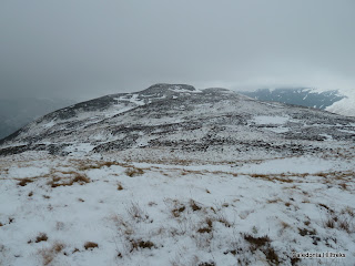
Beinn an t-Sidhein
Beinn an t-Sidhein, Trossachs. – Section 1C.Height – 572 meters. Map – OS Landranger 57.
Climbed – 26 December 2010. Time taken – 3 hours.
Distance – 6 kilometers. Ascent – 525 meters.
Trip Report Details:
The forecast was for windy and deteriorating weather conditions later in the day so I settled for a morning ascent of the Sub 2000 Scottish Marilyn, Beinn an t-Sidhein.
I parked in the Forestry Commission car park just off the main street (A84) in the village of Strathyre. The surface was covered in hard packed snow so before leaving I fitted my microspikes. It was a short walk to the partially frozen River Balvag, which I crossed via a footbridge, and onto the single track road on its west side.
This road was followed north to beyond the school where a blue and green marked trail led through the trees. The path was closed off for forestry operations but as it was a Sunday and Boxing Day I thought work would be suspended for the holiday.
The path climbed steeply through the trees to a vehicle track where a large forestry vehicle was parked. It was frozen over so I concluded that work was on hold and walked north along this track for a few metres to where cut timber was stored. Here I took a left onto another vehicle track where I located the blue/ green marked trail.
It was again a steady climb before I emerged onto a third vehicle track where the blue and green routes split. On checking out the blue route it appeared to enter an area of recently cut timber so I decided on the green route which headed north through mature trees.
I was aware that at some point I would have to leave the forest trails and make my own way uphill and onto the open hillside. At the end of the area of mature trees I came to a small stream with some recently planted trees beyond, and decided that this was the point to leave the track. The lying snow was fairly firm and concealed most of the bracken and other obstacles, otherwise underfoot conditions would have been considerably more awkward. There were some deer prints and I spotted a few deer higher up.
On reaching the top of the forest there were two fences to cross. The deer fence was all but collapsed so I stepped over it and the second lower fence was newer but easily crossed. This took me onto the open hillside and I walked across patches of snow and bare heather to climb to the summit of Beinn an t-Sidhein, marked by a few stones and a stick.
I continued out to Beinn Luidh where I had better views across Balquhidder to Kirkton Glen and beyond Strathyre to Loch Earn. The higher tops were covered in cloud and it was forming around frozen Loch Lubnaig. Despite snow flurries I had a quick coffee break before returning by the ascent route.
Photos taken on walk.
