The web site, Caledonia Hilltreks details my ascents of the Munros, Corbetts, Grahams and New Donalds all of which are above 2000 feet. This blog will contain an account of my ascents of the hills below this height as and when they are climbed.

Thursday 31 March 2011

Strathfinella Hill, Kincardineshire.

Summit Strathfinella Hill

Strathfinella Hill, Kincardineshire. Section 7.
Height – 414 metres. Map – OS Landranger 45.
Climbed - 20 March 2011. Time taken – 2 hours.
Distance – 7.5 kilometres. Ascent – 310 metres.
Trip Report Details:

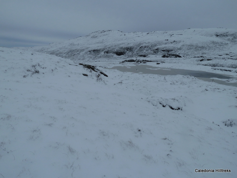
On looking at the map for this Sub 2000 Marilyn I discovered that the hill was covered in trees and getting to the summit wasn’t going to be easy despite various tracks. From experience of forest tracks they don’t always exist or new ones have been added. A GPS, well my one, will not work in forested areas.

I decided to start from Glen of Drumtochty, which runs between the Clattering Brig and Auchenblae. I managed to get my car off the road at the beginning of an old track on the south side of the road. I set off up this track which soon narrowed before it joined a wide forest track that I could have used if I had parked further east.

The track passed under an electricity transmission line and at a junction of tracks I took the left fork. On this stretch of track it was one the few occasions I had a view as the track ran close to some fields. Unfortunately it was misty but I could identify the village of Auchenblae.

At the next junction I took a right turn and soon afterwards came to a third junction where I headed left. (I later discovered this was where I went wrong. I should have gone right and after a few metres taken a left up a path not marked on my map but shown on a 1:25000 map.) I continued along this left hand track looking for the path marked on my map which would take me close to the summit of Black Hill. However I never found it.

I came to a wide new track that headed right and climbed steadily through the forest for well over a kilometre. Despite the mist I was aware that I was on the wrong side of Black Hill. The track came to an end but the forest was impossible to penetrate. I therefore retraced my steps for a hundred metres or so until I found a way through the mature fir trees and over some fallen timber.

This took me onto the path I had planned to use so I followed it west. There were some patches of snow and visibility was impaired by mist although that made little difference as I couldn’t see very far anyway for the trees. I found a small path that went off to my right and walked along it searching for the trig point. I was pleased to locate it off to my left and hidden under a fir tree.

I returned initially by the ascent route but where I emerged from the fir trees I continued down the path, which was wet and boggy in places and blocked by a fallen tree. As this path wasn’t on my map I was interested to discover where it led. It emerged as indicated above and I followed the outward route back to my car.

Photos taken on walk.

Tuesday 29 March 2011

Hill of Garvock, Kincardineshire.

Hill of Garvock

Hill of Garvock, Laurencekirk. Section 7.
Height -277 metres. Map – OS Landranger – 45.
Climbed - 20 March 2011. Time taken – 1 hour.
Distance – 4 kilometres. Ascent – 60 metres.
Trip Report Details:

The start for this walk was the B9120, east of Laurencekirk, at the highest point on the road. Here there was a large parking and picnic area looking across The Howe of Mearns to the west and the North Sea to the east. Unfortunately it was rather misty so I didn’t get the best of views.

I set off through a gate and headed south-west, on an easy gradient, across a field following the edge of a fence and a separate single strand electric fence. These fences later turned east but I continued in the same direction staying on the crest of the hill.

There were in fact four fields to cross but I got the impression that walkers weren’t welcome, at least on this route. I’ve already mentioned the electric fence but there was a second, which wasn’t in use, beside a cattle grid. Before that I came to a double fence where a couple of old gates were tidied down with barbed wire. There was also a strand of barbed wire along the top of the gate and fence. This meant for a slightly difficult fence crossing.

Once clear of these obstacles it was an easy stroll to the summit trig point and the Tower of Johnston. I was surprised to find the tower door open so I climbed the spiral stone steps to the top. There were a couple of steps missing or worn away which did make it awkward on the descent. Unfortunately as mentioned earlier the views were a bit hazy but it would be a grand viewpoint on a clear day.

I returned by the ascent route re-crossing the obstacles.

Photos taken on walk.

Monday 28 March 2011

Meall Coire an Lochain, Cromalt Hills.

Meall Coire an Lochain

Meall Coire an Lochain, Cromalt Hills. Section 15A.
Height – 517 metres. Map – OS Landranger – 15.
Climbed - 12 March 2011. Time taken – 4.5 hours.
Distance – 11 kilometres. Ascent – 575 metres.
Trip Report Details:

This was my last day in the North-West Highlands and with a reasonable forecast until later in the day I set off for the Cromalt Hills, an area I hadn’t walked in before. There are two Sub 2000 Marilyns on this range, one at either end but are around 8 kilometres apart so I settled for the westerly one.

I parked in the snow and ice covered car park at the Knockan Crag Visitor Centre just south of the hamlet of Elphin on the A835. From the car park I had fantastic views across Lochan an Ais to the snow covered Cul Beag and Cul Mor. There was a circular route round the crag so I took the south approach where there was a warning sign of ice, which was very appropriate. The snow covered path was well constructed and where it steepened there was quite a bit of ice to avoid.

The path levelled out and after several metres I left it and climbed over the snow covered heather to Cnoc an t-Sasunnaich before descending slightly to the Bealach a’Phuill and onto the 420 metre knoll. The going was rather rough with lots of bog and some peat hags. I wasn’t sure whether the snow was making progress easier or not but it did make the terrain more obvious while concealing the bog.

I had considered a direct approach to Meall Coire an Lochain but settled for staying high where possible. From the 420 knoll I descended to the east side of a frozen lochan and climbed Meall Odhar before continuing round the north-east side of Meall nan Dearcag Beag. Beyond some lochans the ground became rockier and steeper. I ascended the narrow gully splitting the north-west face of Meall Coire an Lochain and when the gully later opened up I climbed steeply onto the south-west ridge. It was then an easy walk to the summit cairn where I had lunch. The views south to Ben Wyvis and the Beinn Dearg mountains were now restricted as the cloud base began to lower.

My plan was to return by the ascent route but with all the undulations I decided to make a more direct descent and set off down the north ridge over Cnoc Donn a’Phris towards the Bealach na h-Imrich. Despite the snow cover this descent was relatively easy but it didn’t last. From around the bealach to the Abhainn a’Chnocain, the outflow from Loch Odhar, there was lots of peat hags and bog to negotiate. It didn’t improve either once I had crossed the stream with more peat hags to contend with until I climbed to and reached the north side of Meall Odhar. Here I located my bootprints and returned to the car park by the outward route before the snow started.

Photos taken on walk.

Saturday 26 March 2011

Farrmheall, Cape Wrath Peninsula.

Farrmheall

Farrmheall, Cape Wrath Peninsula. Section 16A
Height - 521 metres. Map – OS Landranger 9.
Climbed - 11 March 2011. Time taken – 2 hours.
Distance – 4 kilometres. Ascent – 350 metres.
Trip Report Details:

Nearly a week of stormy weather in the North-West Highlands meant I never got above 357 metres. However the forecast was for the winds to die down by mid-morning so I was optimistic that today I could get a little higher. My walking companion had given up and returned home.

To avoid the morning winds it was a late start. I parked my car in the small parking area on the north side of the Allt na Gualainne just off the A838, beyond Gualin House which is one of the starting points for the Corbett, Foinaven. The area had a covering of snow from an overnight fall.

The initial ascent was wet and boggy and wasn’t improved by the wet snow but as height was gained the ground became firmer and the snow drier. From the parking area I worked my way onto the south ridge of Farrmheall where I thought there were traces of a vehicle track concealed by the snow.

It was then a gradual climb of the south ridge where I was surprised to see a few traffic cones positioned on the hillside. I wasn’t sure of their purpose until I later discovered a telecommunication tower to the north of my intended summit and thought that there might be a connection.

Higher up the gradient eased and the ridge became a bit stoney with some minor snowdrifts. I already had views of Foinaven, Beinn Spionnaidh and Cranstackie but I could now see the Kyle of Durness and out to the Atlantic. It was a gentle rise to the summit cairn where my views west were obscured by an approaching snow shower. However gone were the strong winds of earlier in the week.

I had lunch sheltering behind the cairn and once the shower had past I was able to see out towards Sandwood Bay and the hills of the Cape Wrath peninsula. A few photographs were taken before I returned to my car by the upward route.

Sunday 20 March 2011

Glas Bheinn, Glenelg.

Glas Bheinn

Glas Bheinn, Glenelg. Section 10A.
Height – 397 metres. Map – OS Landranger 33.
Climbed - 4 March 2011. Time taken – 5.25 hours.
Distance – 12.5 kilometres. Ascent – 615 metres.
Trip Report Details:

A couple of the hill baggers had headed home so our numbers were down to three. I had mentioned that the previous weekend I had been on the south side of Loch Alsh to climb the Sub 2000 Marilyn, Beinn a’Chuirn but hadn’t been up the adjacent Glas Bheinn. Some years ago Shona had a family holiday staying at Bernera Farm to the south of Glas Bheinn and was keen on a return visit to the area.

We drove to Bernera Farm on the Glenelg peninsula and parked just beyond the farm. Once geared up we set off up Glen Bernera on a muddy vehicle track. It soon became apparent why the track was muddy. As well as being used by farm vehicles cattle had free range. This was a concern to Shona and things became worse when we discovered that they were eating cattle cake recently spread on the track by the farmer.

On passing the cattle we entered the forest and followed the track as it gradually gained height and swung round the head of the glen. We ignored an area of open ground but as the track began to head south-east we reached another clearing, not marked on the map, and here left the track. A steep climb through bracken and heather slowed progress and with the cloud down we couldn’t see the route ahead. We came to more trees but a narrow break in the forest led to the open hillside.

Sue wanted to practice her navigation so she led us onto the south ridge, avoiding the crags, and to the summit trig point where we had an early lunch. The map also showed the name Carn Cloinn Mhic Cruimein and a Google search revealed that “nine-nines” of MacCrimmons were buried there having been slain in battle.

Occasionally we thought the cloud may lift but it didn’t. It was decided to head north-east and descend, when suitable, to the beach at Camus nan Gall. On the descent of this rocky and undulating ridge we dropped below the cloud base and had views of Kyle of Lochalsh and the Skye Bridge. The trees below had been forested and would have made walking difficult so we continued along the ridge before descending steeply through some birch trees. This led us to the south shore of Loch Alsh, just west of Ardintoul, and the Right of Way that runs from the Glenelg Ferry to Totaig.

We followed the Right of Way west to the headland at Garbhan Cosach where the path rose above the west shore of the Kyle Rhea straits. This narrow band of water, which separates the Island of Skye from the mainland, looked more like a large river as the waters moved through the narrows.

The path ended at the slipway for the ferry, which is open from Spring until October, as an alternative route to The Misty Isle. A short walk along the road returned us to Bernera Farm.

Photos taken on walk.

Monday 14 March 2011

Creag Mhor, Sallachy

Creag Mhor

Creag Mhor, Sallachy, Dornie. Section 12A.
Height – 407 metres. Map – OS Landranger 25.
Climbed - 28 February 2011. Time taken – 2.75 hours.
Distance – 5 kilometres. Ascent – 455 metres.
Trip Report Dteails:

The hamlet of Sallachy, on the north-west shore of Loch Long, was the starting point for this Sub 2000 Marilyn. I don’t usually have company on these lower hills but today I was joined by a Munro bagger who thought she would have an ‘easy day’.

I parked on the grass verge near a narrow tarred road that wound its way uphill. We walked along this road, which passed a mixture of old and new houses, to a croft just above an area being cleared, possibly for another new house. The road terminated here so we crossed a fence into ground used by construction vehicles. A short walk through this area led to an unstable deer fence and once over it onto the open hillside.

It was a lovely sunny morning and warm work as we climbed through a mixture of heather and bracken. The ground steepened and became a bit rocky before levelling out. The summit area had two small cairns each perched on a band of rock and I’m uncertain as to which was the highest point.

We took shelter from a cool summit breeze looking across Loch Carron to Kishorn and the mountains of Applecross. We also spent time trying to identify some of the distant hills.

Rather than return by the upward route we walked over to the south top and descended steeply to a stream which we followed through heather and bracken to the local water treatment works. Here a track led to the road and a short walk back to my car.

Photos taken on walk.

Thursday 10 March 2011

Beinn a'Mheadhoin, Dornie

Beinn a'Mheadhoin

Beinn a’Mheadhoin, Dornie. Section 11A.
Height – 414 metres. Map – OS Landranger 33.
Climbed - 27 February 2011. Time – 2.5 hours.
Distance – 5.5 kilometres. Ascent – 460 metres.
Trip Report Details:

Earlier in the day I climbed Beinn Conchra on the west side of Loch Long. The weather was reasonable despite a hail and sleet shower. On my descent I had good views across the loch to Beinn a’Mheadhoin so decided to add this Sub 2000 Marilyn to my days outing.

From Dornie I drove along the south-east shore of Loch Long, to the hamlet of Bundalloch and parked in the bellmouth at the end of the public road. I then walked across the bridge over the River Glennan and followed a muddy track along the north side of the river. The condition of this track deteriorated due to animals being fed nearby so on finding a section of fence collapsed I crossed it and commenced the ascent of Beinn a’Mheadhoin.

The ground was a mixture of rock and heather and I kept to the highest points where possible. This meant a slight descent to cross the outflow of Loch Dubhach before finally climbing to the summit of Beinn a’Mheadhoin where I had good views of the surrounding mountains.

After lunch I returned to Bundalloch this time avoiding re-ascending any rocky knolls where possible but this did involve crossing short sections of steep terrain.

Photos taken on walk.

Wednesday 9 March 2011

Beinn Conchra, Loch Long

Beinn Conchra

Beinn Conchra, Loch Long. Section 12A.
Height – 453 metres. Map – OS Landranger 33.
Climbed - 27 February 2011. Time – 2.25 hours.
Distance – 3 kilometres. Ascent – 430 metres.
Trip Report Details:

It was a bright and calm morning as I drove along the single track road on the north-west side of Loch Long having left the A87 just east of Ardelve. I passed through the hamlet of Conchra before looking for a suitable parking spot. However there was nothing suitable until the farm building at NG892279.

Once booted up I walked back along the road for a few metres before passing through a gate on the opposite side of the road. It was a steady climb, following a fence, and higher up I crossed another gate. This took me onto the open hillside where the vegetation included some dead bracken which wasn’t very thick and didn’t cause me any problems. Beyond the bracken the ground became a bit steeper with some heather and rocks.

The trig point was reached with views of Loch Alsh, Loch Long, Dornie and Eilean Donan Castle. This wasn’t the summit though. It was over 500 metres to the north and 38 metres higher. An easy walk took me to the summit with views of Sguman Coinntich and the Applecross Hills.

I found some shelter from a cool breeze for morning coffee and later encountered a hail and sleet shower. After the short break I made a more direct return to my car missing out the trig point.

Photos taken on walk.

Monday 7 March 2011

Beinn a'Chuirn, Kintail.

Beinn a'Chuirn

Beinn a’Chuirn, Kintail. Section 10A.
Height – 603 metres. Map – OS Landranger 33.
Climbed - 26 February 2011. Time – 3.25 hours.
Distance – 8 kilometres. Ascent – 705 metres.
Trip Report Details:

I was staying in Plockton so it was a reasonably short journey to Letterfearn, on the south shore of Loch Duich, reached along the single track road from Sheil Bridge, on the A87, to Ratagan and then an even narrower road to Letterfearn. Just beyond the fish farm I managed to get my car off the road adjacent to a passing place.

The start of the walk was across some wet and boggy ground followed by a short steep ascent before the gradient eased. However the underfoot conditions were rather difficult due to large areas of dead bracken.

A fence was followed and this took me to the local water treatment works where I located an old overgrown vehicle track. It soon disappeared in the bracken so I headed for and crossed the Allt an Inbhir, which was my initial plan. Immediately on the opposite bank a deer fence marked the boundary of a forest.

The deer fence soon changed direction and I climbed steadily south-west through heather and rocks as I worked my way round Coire Inbhir. Higher up the gradient eased as I walked round numerous knolls before arriving at the summit trig point.

It was rather cloudy to the south but to the west I had views of Kyle of Lochalsh and the Skye Bridge, to the north, Dornie Bridge, Loch Long and Eilean Donan Castle, and to the east The Five Sisters and with a break in the cloud The Saddle.

After a while I returned to the start by a slightly more direct route which involved a steep descent through heather and rocks into Coire Inbhir. However lower down I still had the dead bracken to walk through.

Photos taken on walk.